Improvements of the amenities and access to the banks of the Danube
Flood protection at Schwabelweis, Regensburg
 © Mit freundlicher Genehmigung der Stadt Regensburg
 © Mit freundlicher Genehmigung der Stadt Regensburg
 © Mit freundlicher Genehmigung der Stadt Regensburg
 © Mit freundlicher Genehmigung der Stadt Regensburg
 © Mit freundlicher Genehmigung der Stadt Regensburg
 © Mit freundlicher Genehmigung der Stadt Regensburg
In the period from 2003 to 2006, the Free State of Bavaria, represented by the Regensburg Water Board, together with the City of Regensburg, organised a Europe-wide interdisciplinary competition with a subsequent optimisation phase. It was a mandatory requirement that landscape architects, architects, and structural engineers worked together on the designs. An important principle of the design was to continue the structure between the river bank and the city in such a way that the existing qualities would be retained, any lost amenities would be regained and, in places, supplemented.
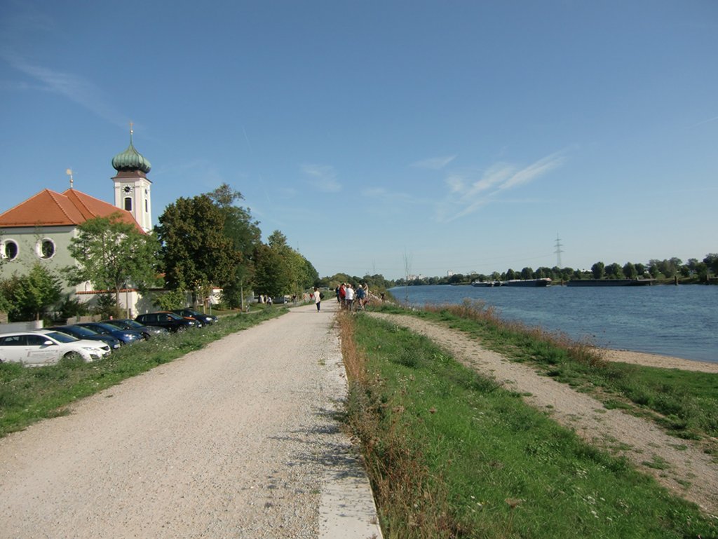
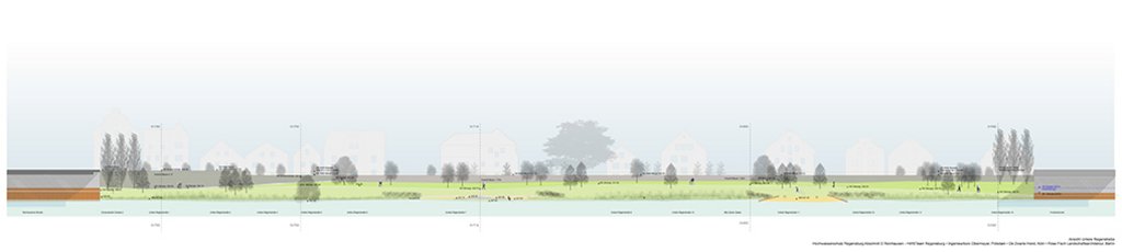
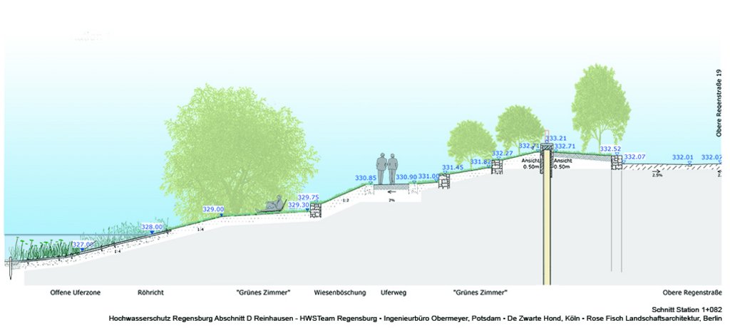
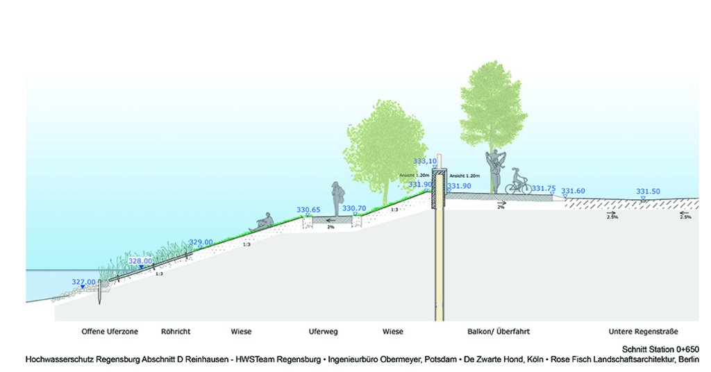
One of the first design sections to be implemented on the basis of the competition design is Section A in Schwabelweis at the left-hand bank of the Danube as it passes the city to the east. For a length of 1.9 kilometres, the existing flood defence structure has been upgraded to form a dyke with a structural sheet pile wall at its core to provide flood protection of HW100+50 cm freeboard.
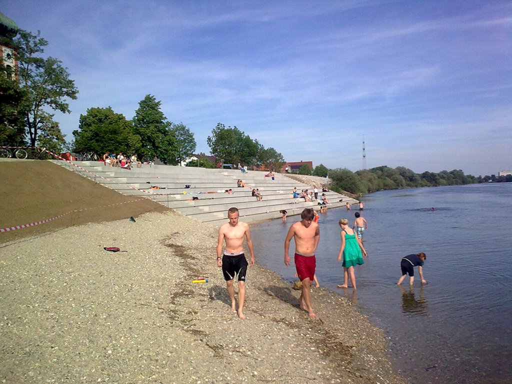
Special attention had to be paid to the modest but significant church with its neighbourhood at the edge of Regensburg – it defines the contour of a flight of generously dimensioned open steps. In addition, the old traditional level measuring station was integrated into the structure. In parallel, the meadow landscape was upgraded by rehabilitating the dry herbaceous grass slopes of the dyke, with its southern exposure, and improving the Danube floodplain by creating a naturally designed secondary channel of the Danube and by creating retention areas.
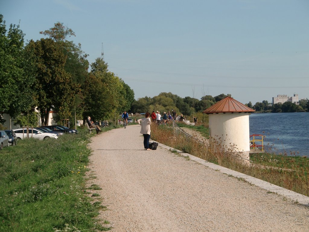
An important aspect was to tie in the new structures with the existing, taking into account the network function of the area in its regional and wider context. The Danube cycle path gives this area special importance as an approach to the city. Furthermore, the Schwabelweis river bank is an important asset in terms of a recreational facility close to residential areas. With sunbathing meadows and a generous system of steps between the dyke and the Danube, contact with and access to the river are created.
This project was presented as part of the 2015 Baukultur Workshops in Regensburg.
| Completion | 2011 |
| Planning period | 2006–2011 |
| Developer | City of Regensburg, City Planning Department, in cooporation with the Free State of Bavaria; Regensburg Water Board |
| Architect / planner | Wolfgang Weinzierl Landschaftsarchitekten GmbH, Ingolstadt; Studio di Architettura Prof. Dr. Vittorio M. Lampugnani, Milan; Goldbrunner Ingenieure GmbH, Gaimersheim |
| Size / area | 1.9 km dike length |
| Building costs (gross) | 4.3 M € |
| Uses | Open space Infrastructure Public construction |